Archeological buried remains detection by remote sensing
High resolution remote sensing has demonstrated successful results for the detection of surface anomalies linked to the presence of archeological buried remains by non-invasive methods. It is a quick and economic method complementary to other field surveys.
Why is it possible to detect archeological buried structures from images?
The explanation is easy. Although the structures are buried, they are at a relatively low depth, so its presence influences in the characteristics of the soil and vegetation that are over them.
It is more feasible to detect structures when there is herbaceous vegetation (instead of bare soil) in the archaeological site. In terms of remote sensing, vegetation is the best indicator for the presence of buried archeological remains, since the development and the stress level of this vegetation will be affected, and we will be able to detect it.
If the vegetation is a crop, much better. The differences will be more notable because the presence of structures breaks with the homogeneity of the crop, giving rise to “crop marks”.
As shown in the figure, the presence of structures (such walls) means lower soil availability for root development in the plants. These root systems have smaller area for growing and lower water availability as well. Therefore, it will have a negative effect on plant development (lower growth, higher water and nutrient stress). However, the presence of negative structures (such pits and ditches) is linked with precisely opposite effects. A higher soil availability allows a bigger root system development (higher growth, lower sensitivity to water and nutrient stress).
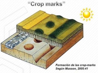
In the case of woody vegetation (shrubs and trees) the detection of buried archeological remains is not feasible through spectral vegetation analysis since this kind of plants are not so sensitive to these small variations of the subsoil.
In the case of bare soil (there is no vegetation cover in the archeological site) the detection is still possible, the presence of the structures affects to the soil water holding capacity and therefore its temperature is different. Positive structures are linked with higher temperatures (less soil water holding capacity), and negative structures with lower temperatures (higher soil water holding capacity).
How can we detect the structures according to the type of sensor?
Understanding the pilars on which the detection of structures is based, we can know how each type of sensor can help us to perform the detection.
RGB sensor
It allows the identification of crop coloration variations perceptible to the naked eye from an orthophoto.
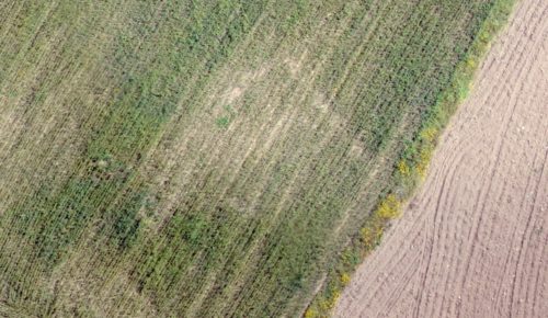
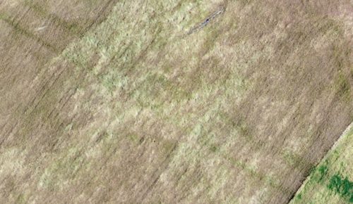
The effects of the buried structures can be observed in the following examples. In the left side image can be observed the presence of positive structures (walls), which have affected the crop growth over them. In the right side image, it can be observed negative structures () which are perfectly visible because of a higher crop growth.
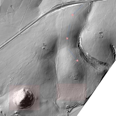
On the other hand, it is also possible to detect structures from the Digital Surface Model (DSM) obtained during image processing. As seen before, the presence of this kind of structures could generate changes in crop height or even in micro-relief.
multispectral/hyperspectral sensor
Thanks to the information provided by these sensors, we are able to detect subtle changes in crop no perceptible to the naked eye such as little differences in vigor or nutritional status caused by the presence of buried remains. Therefore, this kind of sensor provides a higher amount of information than RGB sensors, since they acquire information in a wider range of the spectral region and it allows more advanced analysis.
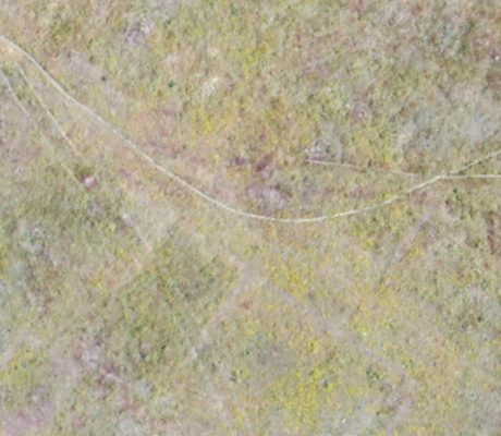
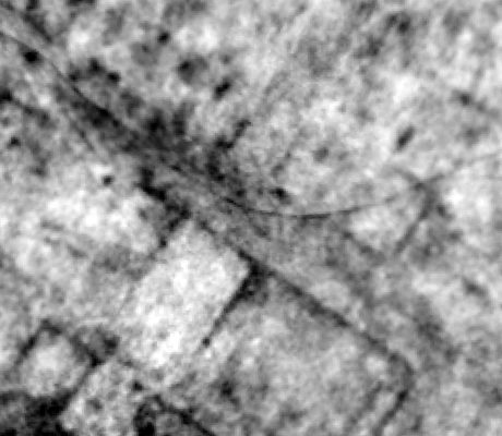
In the following examples it can be observed how buried structures are not visible with RGB sensors (left side image), but they appear perfectly delineated once the proper algorithms are applied in a multispectral image of the same area (right side image).
Thermal sensor
It allows the identification of anomalies in crop water status, as well as surface temperature changes in the case of bare soil, caused by the presence of buried structures.
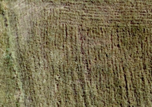
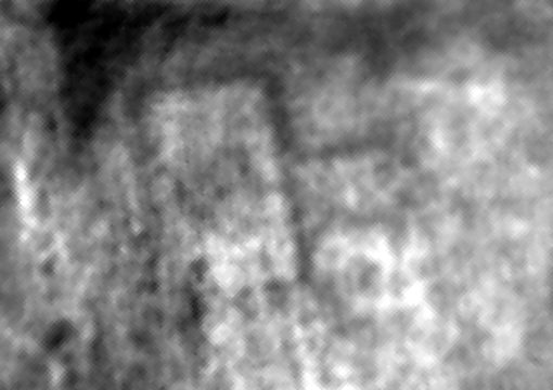
In the following example it can be observed how the presence of a buried structures are not visible with the RGB sensor (left side image), but they are perfectly recognizable thanks to the crop water stress analysis.
Conclusions
As already discussed, the buried archeological remains detection is possible by performing a proper airborne images analysis, yielding very good results in crop and herbaceous areas.
One of the main advantages is that it allows to analyze bigger areas in a faster and more economic way than traditional field survey methods. In addition, it provides the archeologist with a complete idea of the archeological site for campaigns planning, areas delimitations, etc.


